What is a thunderstorm alert?
We detect thunderstorms using primarily Infrared satellite data. A thunderstorm alert means that storms may soon affect your area or your planned route. These storms can bring:
- Sudden strong wind gusts
- Rapid wind shifts
- Heavy rain and poor visibility
- Lightning
- Short, steep waves and confused seas
Why we use satellite IR imagery
What satellite IR imagery shows
- It measures how cold the tops of clouds are.
- Colder cloud tops = taller, stronger storms.
- Rapid cooling means the storm is growing stronger.
Why this matters at sea
- Satellite IR works day and night.
- It detects storms before rain or lightning reach you.
- It helps us see storms far offshore, where radar coverage may be weak or unavailable.
What to pay attention to when you receive an alert
When you get a thunderstorm alert, focus on these points:
Where is the storm?
- Is it on your current position, ahead of you, or behind you?
- Is it along your planned route?
When will it affect you?
- Is the storm already active or still developing?
- How fast is it moving toward you?
- Do you have time to delay departure, change course, or seek shelter?
How strong does it look?
From satellite IR signals:
- Very cold cloud tops usually mean strong winds and heavy rain are possible.
- Large storm areas are harder to avoid than small, isolated cells.
Is it moving?
- Fast-moving storms bring short but intense impacts.
- Slow-moving storms increase the risk of long-lasting wind, rain, and rough seas.
What past satellite IR images can tell you
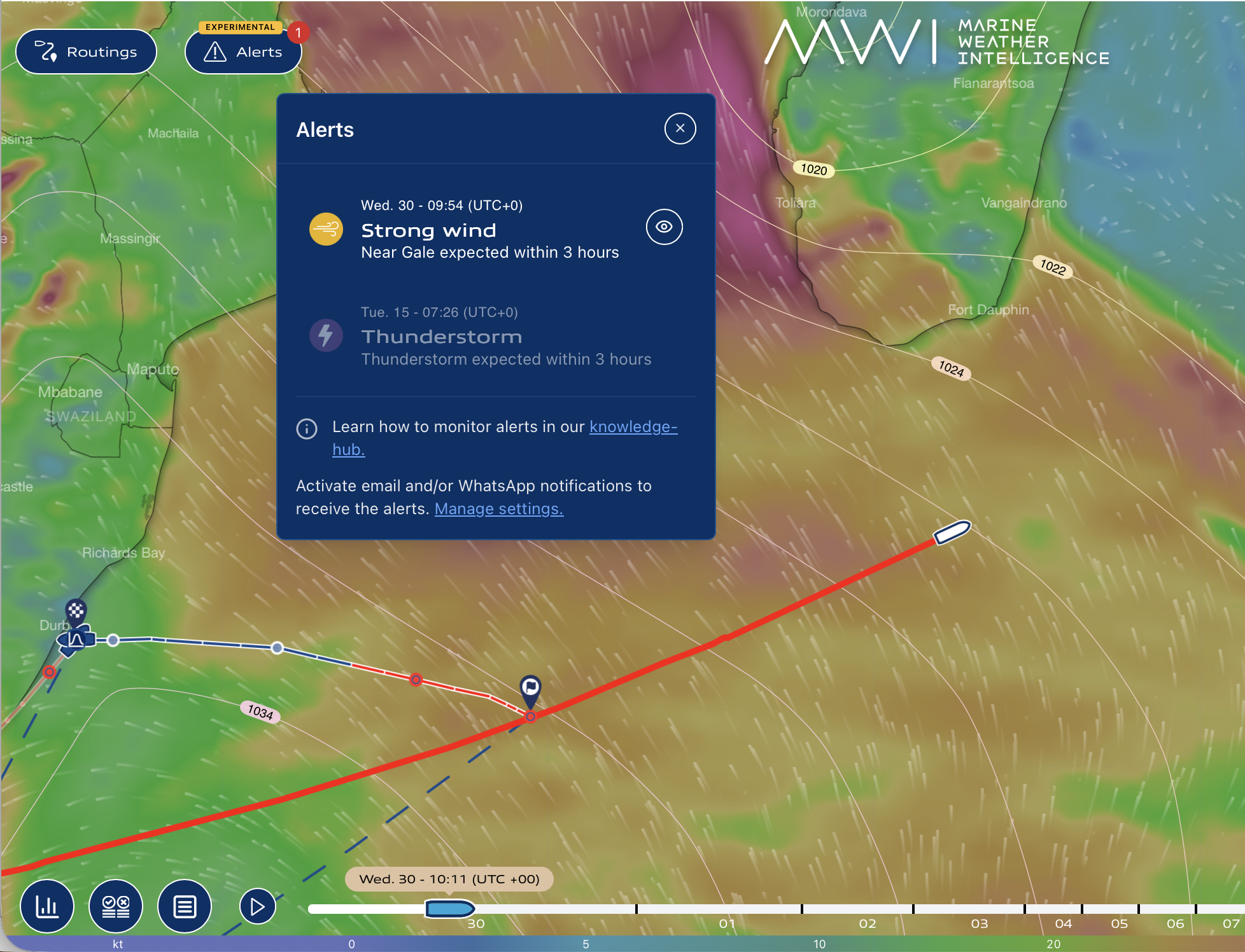
When you receive a thunderstorm alert, click on it and the satellite image layer will be displayed on your screen. Looking at how storms behaved over the last few hours helps estimate what may happen next.
Storm life stage
From IR image loops we can see if a storm is:
- Developing: cloud tops getting colder quickly (conditions may worsen soon).
- Mature: very cold and stable cloud tops (highest risk period).
- Weakening: cloud tops warming (conditions may slowly improve).
What kind of storm system Is It?
- Single storm cell: small, short-lived but can still be dangerous.
- Storm cluster: several storms close together; harder to navigate around.
- Organised system (line or large area): often brings strong winds and widespread rough seas.
Speed and direction of motion
By watching IR images over time, we can:
- See where the storm is heading
- Estimate when it will reach your area
- Identify if storms are merging or growing along your route
What could happen in the next few hours
Satellite trends help us estimate short-term risks such as:
- Storms becoming stronger than forecast
- New storms forming nearby
- Storms lasting longer than expected
- Conditions deteriorating faster than wind or wave forecasts alone suggest
Satellite imagery is especially useful for nowcasting (the next 0-3 hours).
How to use satellite alerts together with your weather layers
Radar
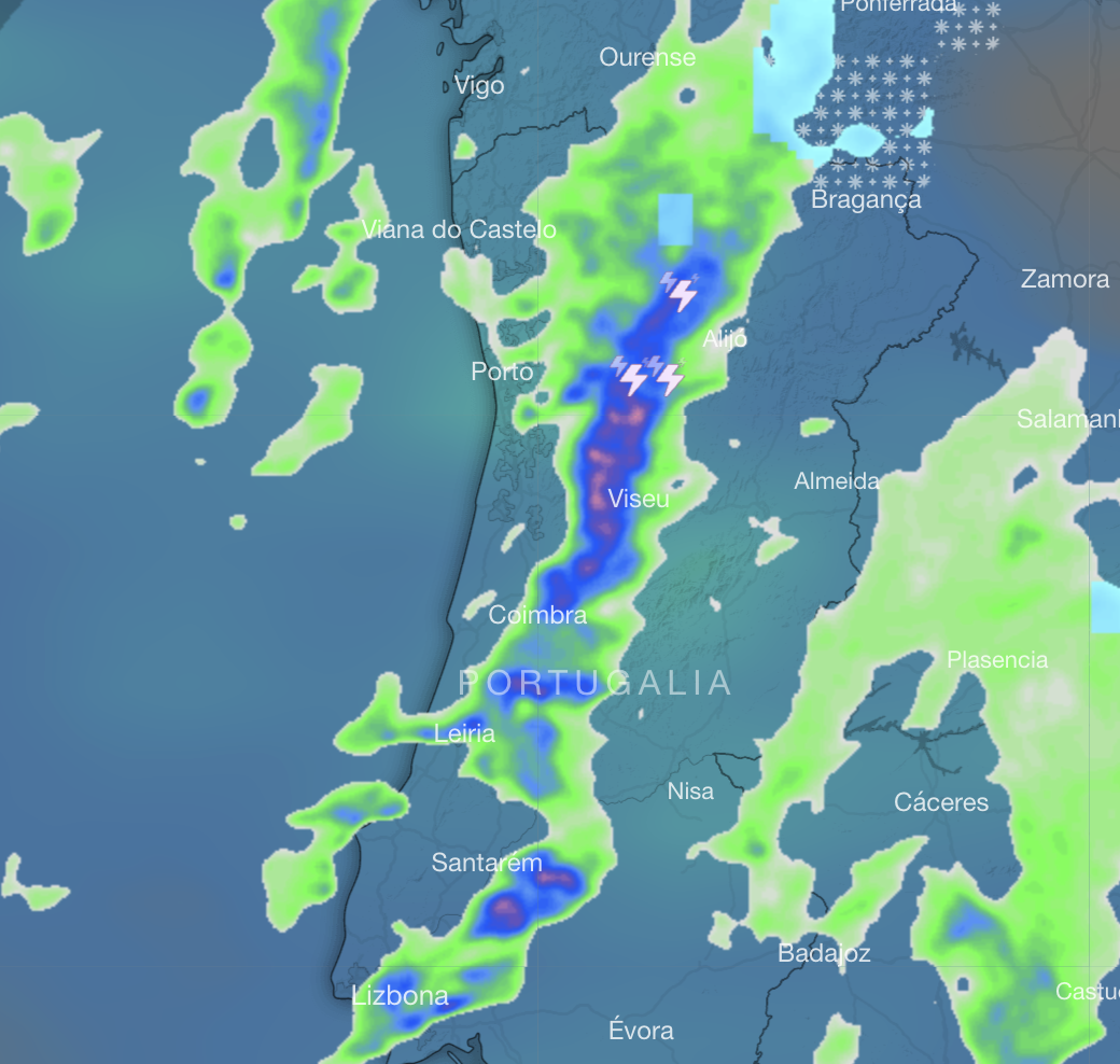
- Radar shows where rain is right now.
- Satellite IR shows where storms are growing, even before rain appears.
- If IR shows strong storms but radar is still weak, expect worsening conditions soon.
Rain & thunderstorm forecast
- Forecasts show what is expected.
- Satellite shows what is actually happening.
- If storms appear earlier or stronger than forecast, be more cautious.
Wind forecast
- Thunderstorms can cause sudden wind gusts well above forecast values.
- Expect sharp wind shifts near storms, even if the general forecast looks stable.
Wave forecast
- Gusty winds and storm outflows can quickly create short, steep waves.
- Wave forecasts may not fully capture these rapid changes.
Example satellite images and how to interpret them
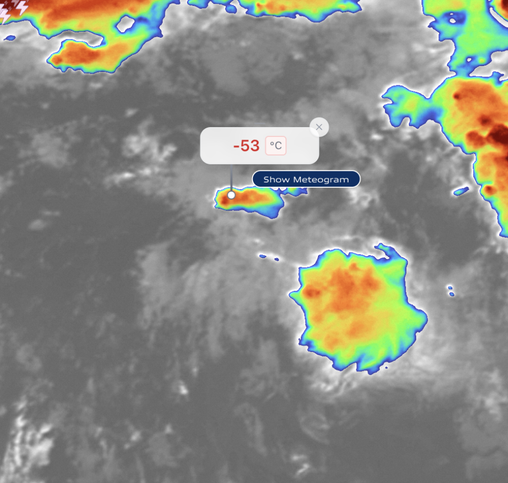
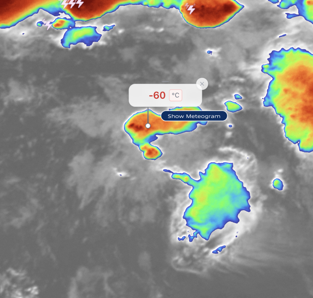
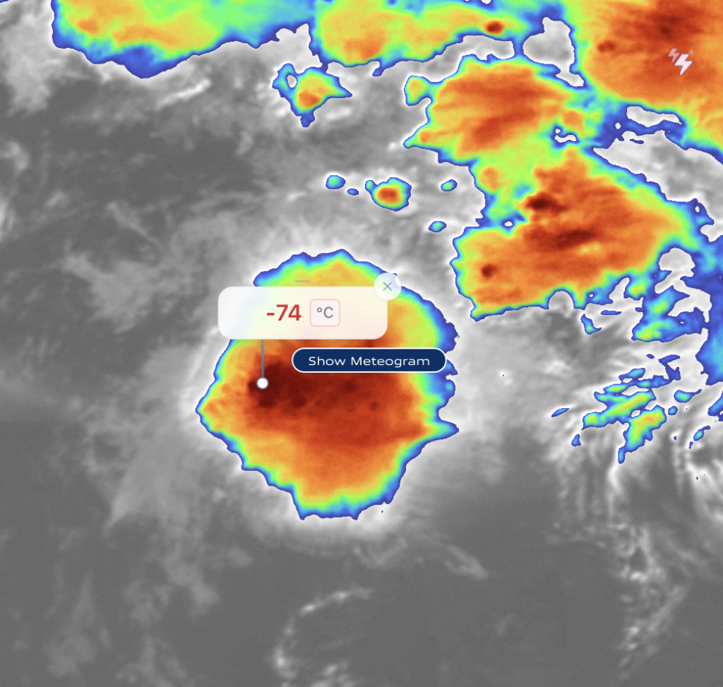
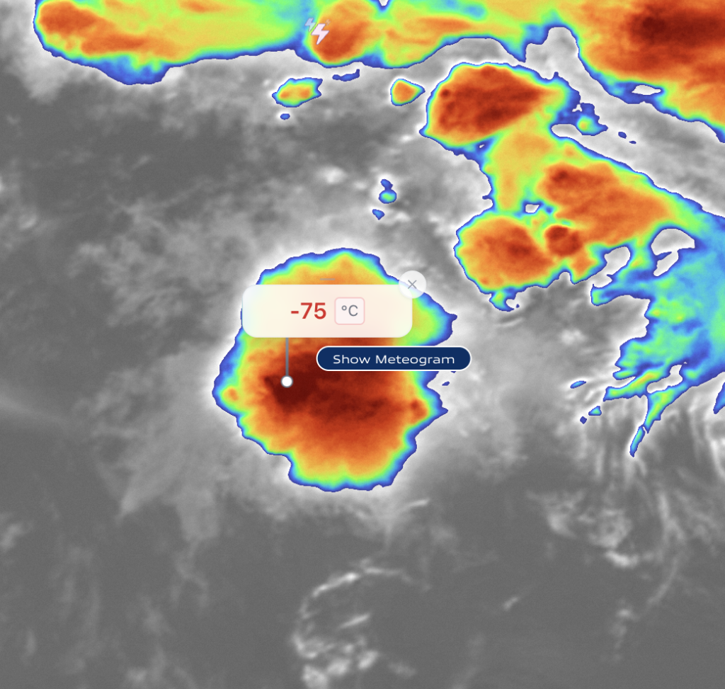
Developing thunderstorm
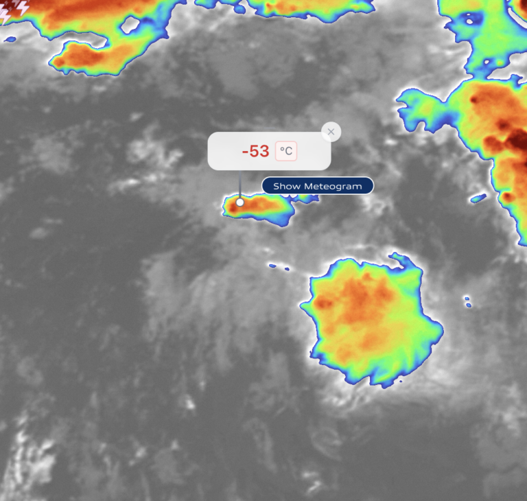
In the beginning clouds are small and moderately cool. In a short period of time, the cloud tops cool rapidly and expand. This indicates that the conditions can worsen rapidly in the near future.
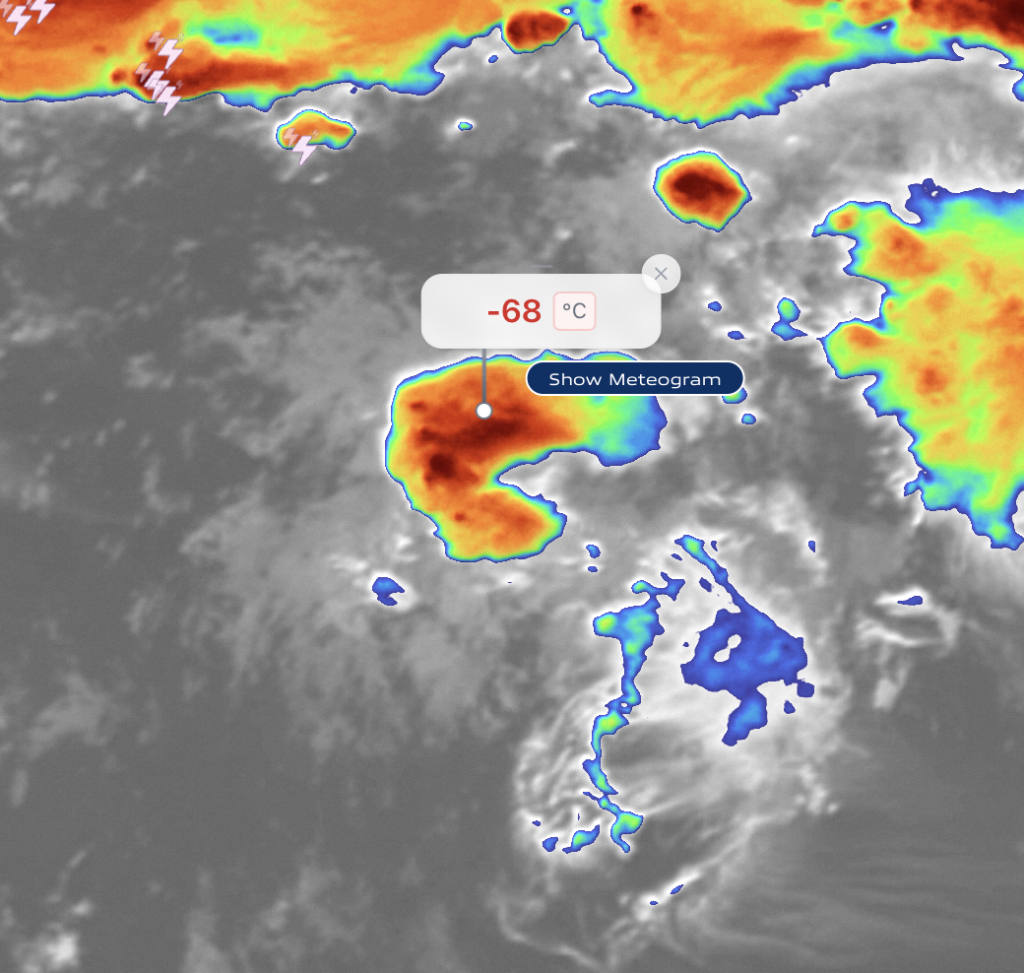
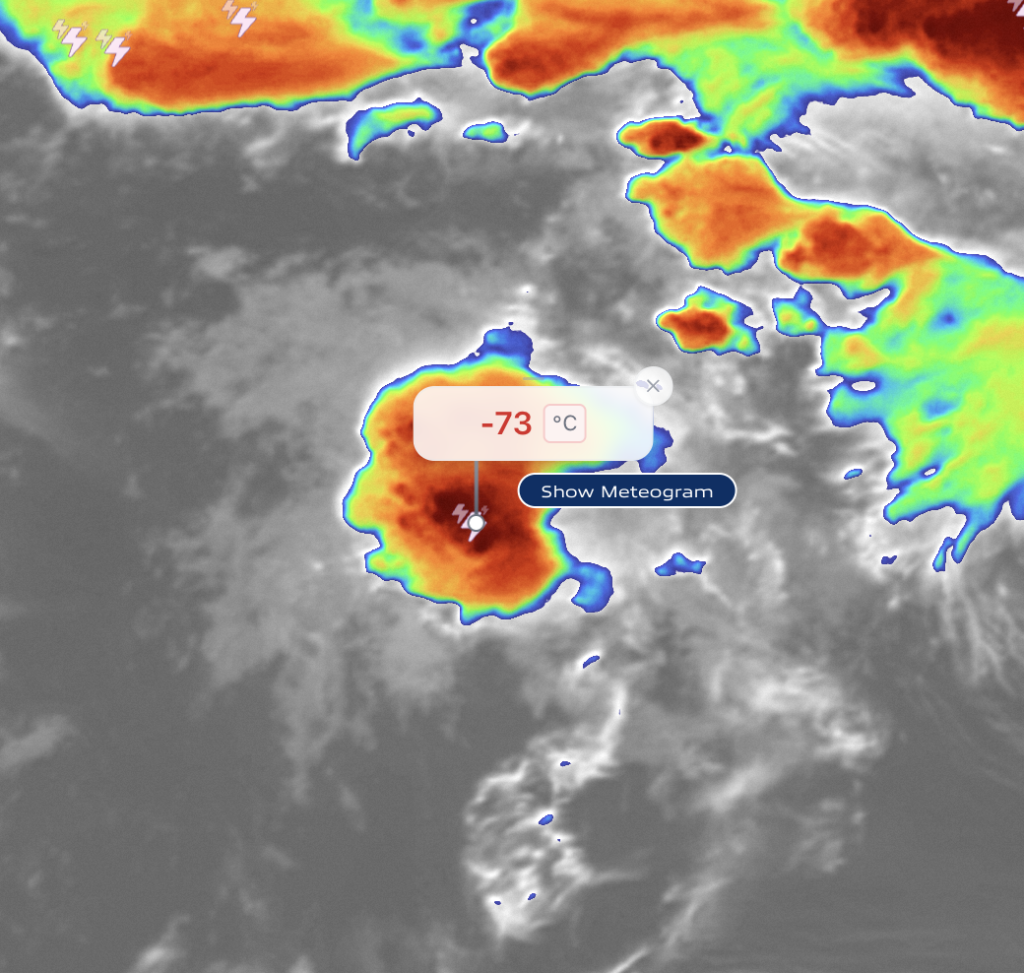
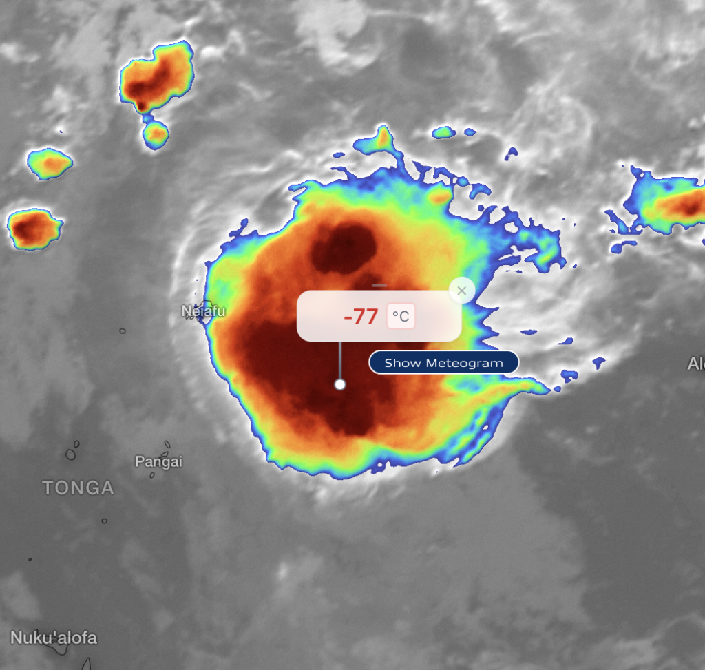
Mature thunderstorm
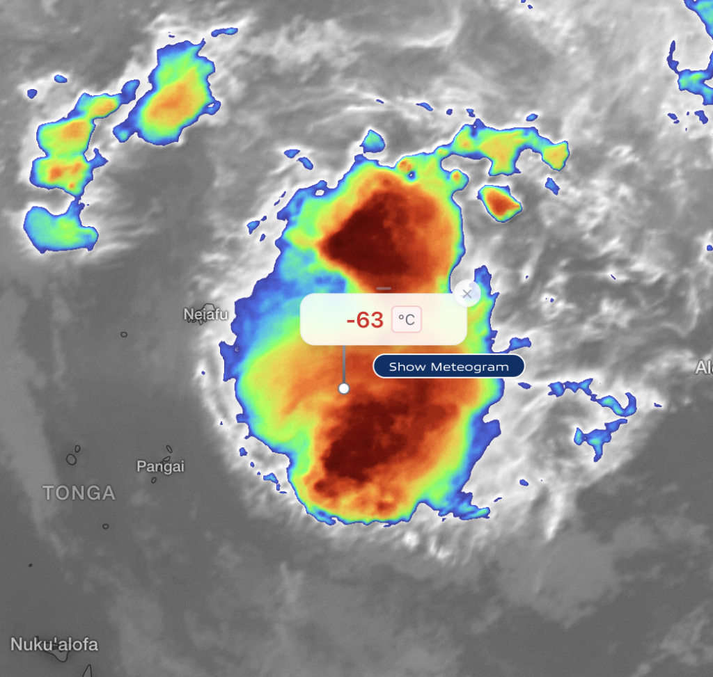
Mature thunderstorms extend over large areas and have very cold cloud tops. The storm maintains its shape and size. This is potentially the most dangerous stage of storm development as it might bring strong winds, heavy rain, lightning, and rough seas.
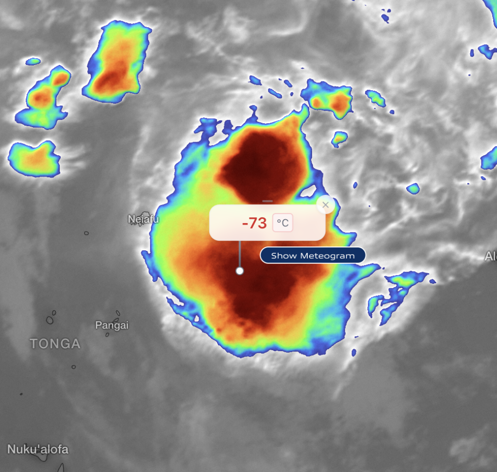
Weakening thunderstorm
In this stage, cloud tops slowly warm and storm area shrinks and breaks apart. This means that the conditions may gradually improve, but gusty winds can persist.
Key safety takeaways for sailors
- Thunderstorm alerts are early warnings, not just confirmations.
- Use satellite alerts together with radar, wind, and wave forecasts.
- Pay attention to storm movement, size, and growth trends.
- When in doubt, delay departure, change course, or seek shelter.